
Projects
Recent work
Drone projects in Kingston & Eastern Ontario
A few recent jobs, from thermal roof scans and construction progress flights to RTK mapping and humanitarian deployments. Each one shows what we flew, why, and what the client received.
Thermal inspection · Brockville, ON
Flat-roof moisture scan, Brockville
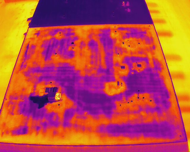
A commercial flat roof was showing signs of a leak, but the source was not obvious from the surface. We flew a thermal scan in the evening after a sunny day, when wet insulation releases its stored heat more slowly than dry areas.
The irregular warm patches in the thermal image mark trapped moisture under the membrane, found from the air before ceiling stains spread inside.
- Matched thermal and visual images of the whole roof
- Each anomaly located and marked for the roofer
- A short report the owner could hand straight to the contractor
Construction progress · Kingston, ON
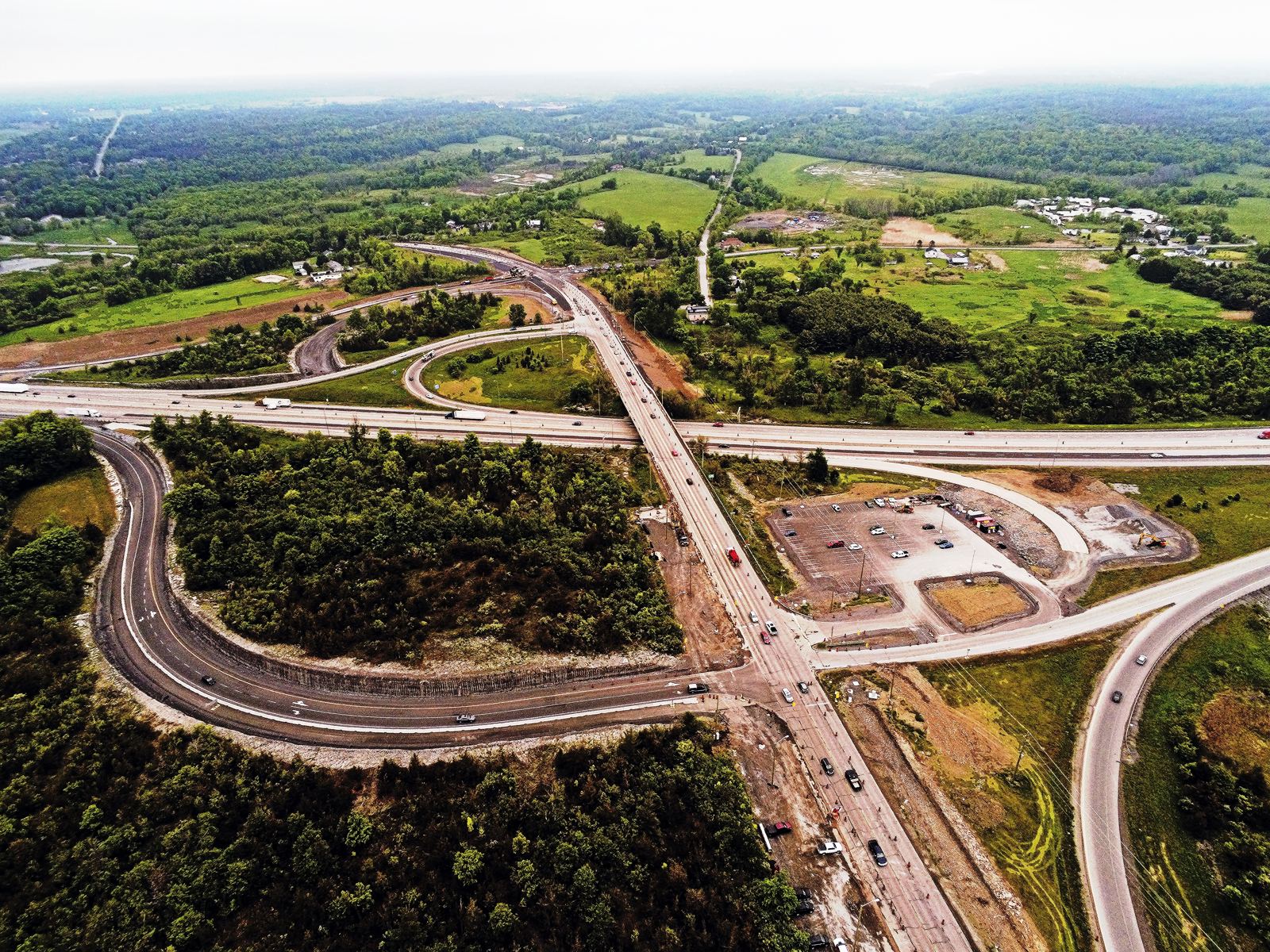
Highway 38 & 401 interchange progress
Road and interchange projects change week to week, and the people who need to see that progress are rarely on site. Aerial progress flights show the whole job in one frame.
We flew the interchange from repeatable positions, so each visit can be compared against the last one.
- High-resolution aerial photos from consistent angles
- 4K video of the full site
- Files delivered within 24 to 48 hours of each flight
Mapping & RTK · Kingston, ON
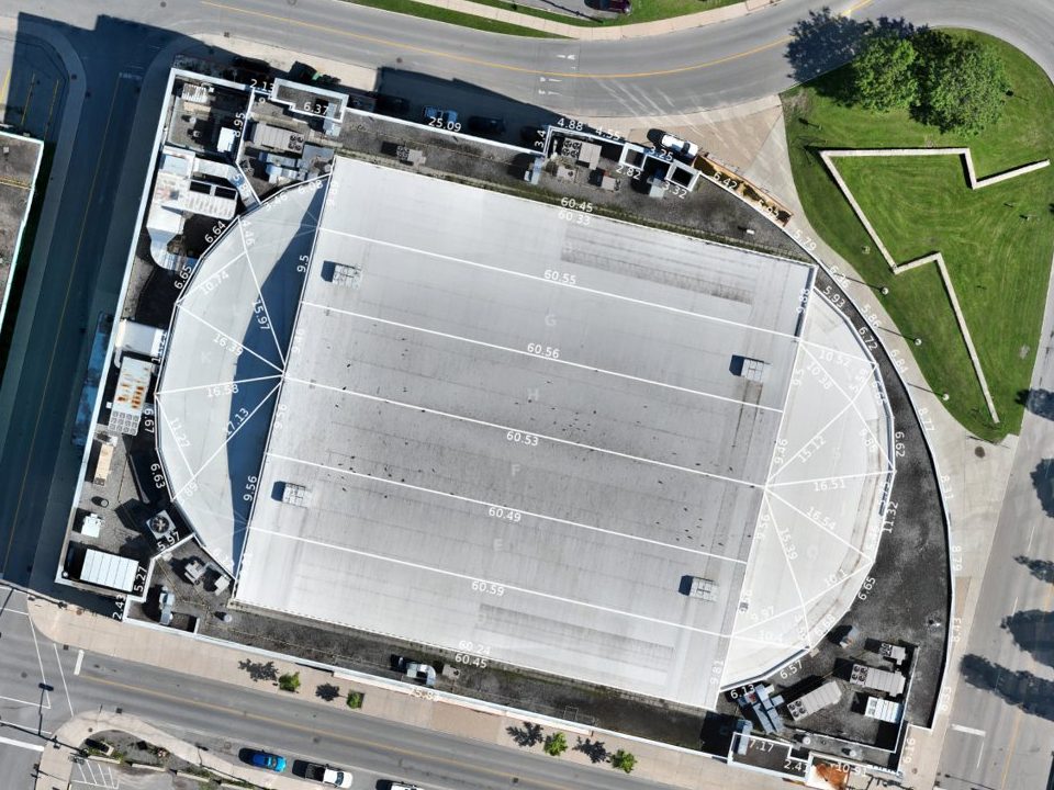
Leon’s Centre roof orthomosaic
Large roofs are hard to see as a whole from the ground, and walking them is slow. An orthomosaic stitches hundreds of overlapping drone photos into a single map that is measurable and to scale.
We mapped the arena roof in downtown Kingston in one automated flight.
- A georeferenced orthomosaic of the full roof
- Measurable to scale, ready for planning and condition review
- Files that open in standard CAD and GIS software
Humanitarian mapping · St. Vincent & the Grenadines
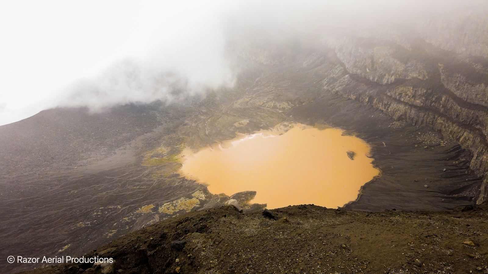
La Soufrière eruption damage mapping, 2021
After the April 2021 eruption of La Soufrière, we deployed to St. Vincent with GlobalMedic to support the Ministry of Agriculture in assessing damage across the region.
Drone mapping gave a fast, safe view of areas that were difficult or dangerous to reach on foot. It is the same discipline we bring to every survey at home.
- Aerial mapping of affected agricultural areas
- Imagery to support damage assessment and planning
- Flown alongside government and non-profit teams