Drone Mapping & RTK Surveys
Centimetre-accurate drone mapping
Drone mapping & RTK surveys in Eastern Ontario
Orthomosaic maps, elevation models, contours, 3D models and stockpile volumes from RTK-equipped enterprise drones, flown in a single automated mission and delivered as files your engineers can open in Civil AutoCAD and GIS.
We map for developers, engineers, aggregate operators, conservation authorities, municipalities and landowners in Kingston and across Eastern Ontario.
What you get
From $895 + HST up to 25 acres · $20/acre beyond
Centimetre-accurate digital twins of your site from RTK-equipped drones, with an in-depth analysis in a single flight.
What you get
- Georeferenced orthomosaic
- Elevations and digital terrain model (GeoTIFF, raw elevations)
- Contours as .dxf or .shp at 1–5 metre intervals
- 3D model (.obj) and 3D point cloud (.las, .xyz)
- Aggregate pit maps and stockpile volume calculations for compliance reporting
- Drainage, erosion-control and irrigation mapping with a report
Ideal for: Site planning, engineering and design teams. Outputs import directly into Civil AutoCAD. Ask for a sample output link.
How it works
- Share the site boundary, the outputs you need and any control points.
- We fly an automated RTK mapping mission across the site.
- You receive georeferenced files and a shareable model link; ask for a sample first.
Recent mapping work
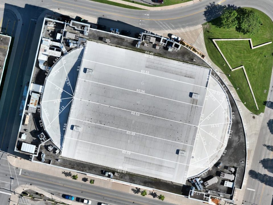
Leon’s Centre roof, Kingston
A high-resolution orthomosaic of the arena roof, measurable and to scale.
Trent-Severn dam
A georeferenced orthomosaic of a dam and spillway stitched from hundreds of RTK-tagged photos.
Tay Valley elevation model
A colour elevation and drainage model of a wooded rural property for site planning.
La Soufrière, St. Vincent
Mapping volcanic eruption damage with GlobalMedic and the Ministry of Agriculture in 2021.
Questions
How accurate is RTK drone mapping?
RTK positioning tags every photo with centimetre-level accuracy, so maps and models line up with your survey data. We can also tie in to your ground control points.
What files will I receive?
A georeferenced orthomosaic, digital terrain and surface models (GeoTIFF), contours as .dxf or .shp, a 3D model (.obj) and a point cloud (.las or .xyz), plus a shareable online model link.
How big a site can you map?
The base quote covers sites up to 25 acres. Larger sites, corridors and repeat flights for progress or volume tracking are quoted per job.
Can you calculate stockpile volumes?
Yes. We measure aggregate and material stockpiles for inventory and compliance reporting, and can repeat the flight on a schedule.
Is this a legal land survey?
No. Drone mapping provides measurable maps and models for planning, design and monitoring. Legal boundary surveys must be done by an Ontario Land Surveyor; our data can support their work.
Have a site to map?
Share the site boundary and the outputs you need, and ask for a sample output link.